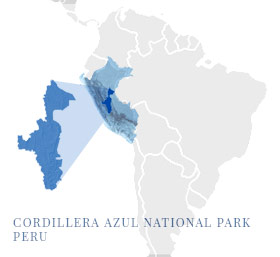
The Cordillera Azul National Park Project in the Peruvian Amazon is home to a rich, diverse and rare biosphere. As with so much sensitive land in the Amazon and other parts of the world, it is under threat from rogue groups looking to poach not just the rare wildlife, but the very valuable trees in this national park.
While the land itself is legally protected from development by a Supreme Decree of the Peruvian government, without active management and protection it would remain at risk of poaching, illegal harvesting and incursion. This protection is provided by a separate organization — Centro de Conservación, Investigación y Manejo de Areas Naturales (CIMA) Cordillera Azul Lima — which relies on carbon finance from the sale of carbon credits to ensure the carbon benefits of this beautiful land are not lost.
The Cordillera Azul National Park Project protects a large, intact expanse of lower-montane forest left in Peru. Its designation as a REDD ((Reduce Emissions from Deforestation and Forest Degradation) certified project, means it meets high standards established by the United Nations for better protection, restoration and management of the world’s forests. The project also meets the requirements of the Verra – Climate, Community and Biodiversity Standard. This ensures that the Cordillera Azul National Park Project also meets sustainable development goals, while sequestering CO2.
The original project area is 1,351,964 hectares. In 2007 the buffer zone was expanded by Peruvian government legislation, resulting in an area of 2,301,117 hectares. This project actively protects the forest from illegal deforestation and uses forest cover, park patrols, and observations by community representatives to assess the effect of the project activities on biodiversity in the project zone.
Flora that’s new to science
At least 12 species of plants likely new to science were recorded during the “rapid inventory” phase of the project, along with hundreds more that were range extensions. Scientists also found plants with unusual biological features or behaviors, including more than 20 species that have obligate mutualism with ants. At least five tree species, all in the genus Tachigali, show evidence of monocarpy (i.e., flowering only once in their life, then dispersing seed and dying). Large, commercially valuable species, mahogany (Swietenia macrophylla) and tropical cedars (Cedrela odorata, Cedrela fissilis) have also been identified. These are now very rare and have nearly vanished from riparian and river floodplain areas due to selective harvesting elsewhere in the tropics.
Endemic and endangered animals
The fauna found at Cordillera Azul includes several endemic and rare mammals. Of the 71 species registered in 2000, 12 are of international concern because of their global rarity. Three species of monkeys are on this list: spider monkey (Ateles chamek), woolly monkey (Lagothrix lagotricha), and saki monkey (Pithecia monachus). The nine other rare mammals are spectacled bears (Tremarctos ornatus), neotropical otters (Lontra longicaudis), giant river otters (Pteronura brasiliensis), tapirs (Tapirus terrestris), white-lipped peccaries (Tayassu pecari), jaguars (Panthera onca), bush dogs (Speothos venaticus), giant anteaters (Myrmecophaga tridactyla), and giant armadillos (Priodontes maximus). The inventory team also found a likely new species of squirrel (Microsciurus “oscura”) and two other very rare species; the water opossum (Chironectes minimus) and the short-eared dog (Atelocynus microtis).
Flocks of rare birds
For the birders out there, this project’s biodiversity includes very rare species of birds; the scarlet-banded barbet (capito wallacei), bar-winged wood-wren (Henicorhina leucoptera), and royal sunangel (Heliangelus regalis). The park also protects large populations of big gamebirds threatened by hunting; the spix’s guan (Penelope jacquacu), blue-throated piping-guan (Pipile cumanensis), wattled guan (Aburria aburri), and importantly, the razor-billed curassow (Crax tuberosa), which is particularly vulnerable to local extinctions.
Also rare: human impacts
There are no organized human communities within the project region, excepting one rancher who was on the land before the project area was protected. The rancher is now a steward of the land providing a watchful eye. The possibility of non-contacted indigenous people from the Cacataibo group living in the southeast region of the park led to the establishment of a “strict protection zone” (Zona de Protección Estricta) in this region, where outside entry into this area of the project is not permitted. Until these people come out of their own volition and request contact, the region remains closed to all entry or use.
Dramatic geology
Cordillera Azul is also home to unique geology. Each mountain range in the park is a separate, uplifted block of mostly Jurassic and Cretaceous strata, which predominate in the north eastern Peruvian Andes south of the Marañon River. Most of these tilted blocks are oriented north and south, but some curve to run east and west. A distinctive geological feature, the Vivian formation consists of rows of flat, sloping triangles of rock up to 7 km broad at the base and 4 km along the ridge resembling giant zigzags. They are well developed and almost perfectly symmetrical in two areas of the park.
New discoveries, but also increasing threats
Local populations use the park for subsistence hunting and fishing. Yet, pressure is building up in the buffer areas from the increasing population of peoples migrating to the region. The importance of the carbon sequestered by this project is evident in the rare and valuable species of flora and fauna, some of which undoubtedly we haven’t yet discovered.
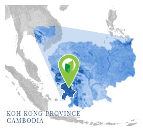
The Southern Cardamom rainforest represents southeast Asia’s largest surviving rainforest habitat. Of the half a billion acres of rainforests that once covered SE Asia, now only about 5% remains; and 20% of that 5% is in Cambodia. Of that 5%, a vital portion of that is the Southern Cardamom REDD+ Project (SCRP).
SCRP is an initiative designed to promote climate change mitigation and adaptation, maintain biodiversity and create alternative livelihoods under the United Nations scheme of Reducing Emissions from Deforestation and forest Degradation (REDD+). The project’s 445,339 hectares encompasses parts of Southern Cardamom National Park and Tatai Wildlife Sanctuary. This protects a critical part of the Cardamom Mountains Rainforest Ecoregion – one of the 200 most important locations for biodiversity conservation on the planet. The Project’s climate benefits include the avoided emission of approximately 12 million t CO2e during this first monitoring period and over 115,000 million t CO2e over the lifetime of the project.
This SCRP also generates substantial community and biodiversity co-benefits. It directly supports the livelihoods of villagers living around the perimeter of the project area and is able to provide educational scholarships to some of the local residents. The local communities generally benefiting from this project represent approximately 4,000 families, and more than 16,000 individuals.
The project supports new and sustainable livelihood opportunities through alternative income generating activities (IGAs). These initiatives are designed to stimulate investment in local businesses and by doing so, reducing pressure on the environment from activities such as logging and poaching, while significantly increasing community well-being. Additional programs will address food security, improving health and education facilities, as well as raise environmental awareness.
Biodiversity co-benefits are achieved through greater protection of the ecosystem, predominantly by means of increased security and improved monitoring. The project protects critical habitat for the Asian elephant, Asiatic black bear, sun bear, large spotted civet, clouded leopard, and dhole, as well as the critically endangered reptiles, Siamese crocodile and Southern river terrapin. Reintroduction of the tiger into the Cardamom Rainforest landscape is also being planned for the project area.
Other co-benefits provides the local communities training on intensive agricultural methods, decreasing conversion pressure on forestland. The communities have access to micro finance, enabling the adoption of new agricultural tools and practices. Participatory land use planning is provided by the project, serving to strengthen systems of land tenure. Inequities in land use rights are a well-known factor contributing to deforestation in Cambodia. Community organizations are strengthened through land use planning, while receiving new knowledge and information on land use best practices.
The community also benefits from the funding of improved health care facilities, and hiring of more health care professionals. The project also supports outreach and education to the local communities, teaching about conservation, and sensitizing the communities to the importance of this carbon project.
The project supports community based Eco-tourism, showing off a beautiful and wonderfully diverse ecosystem, while creating new jobs in the local community. The project also provides funds for hiring new teachers, improving the education system, overall.
The project area and local communities will benefit from the enhanced security and law enforcement. The scope and size of the existing ranger/community member force is enhanced, as it participates directly with the conservation of the forest within the project zone. As the Southern Cardamom REDD+ project continues its conservation work, the lasting changes resulting from this carbon project will benefit the local communities for years to comes.
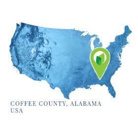
Though less photogenic than some of their carbon offset project counterparts, landfill gas projects play an essential role in the offset ecosystem, primarily by reducing emissions of methane, a greenhouse gas 28 times more potent than carbon dioxide. In Elba, Alabama, the Coffee County Sanitary Landfill has invested in being part of the climate solution by installing a system to collect and combust landfill gas before it can escape into the atmosphere. Without this project and its control of methane emissions, this county landfill would be a significant methane emission source.
There are 48 vertical wells installed within the Coffee County Landfill, with depths that ranging from 12 feet to 88 feet. A blower creates a vacuum that draws the landfill gas from these wells to the main collection header, where the landfill gas is combusted via a flare. The system now meets the rigorous performance standard defined by the Climate Action Reserve landfill gas protocol.
In addition, the landfill’s Non-Methane Organic Compound (NMOC) emissions rate was measured to be 5.3 Mg/yr. (megagrams per year), well below the 50 Mg/yr that would trigger mandatory control of this landfill’s emissions.
The project’s offset calculus accounts for three voluntarily installed passive flares that were used for positive pressure release and odor control prior to the project’s start date. All discounts for pre-project destruction devices were accounted for in the baseline emissions for the current reporting period, and were verified during the project’s initial reporting period.
Looking forward, Coffee County is now planning to use this infrastructure to add an additional layer to its landfill gas recapture program by selling the captured methane as a reusable energy source to a Florida-based recycling company, rather than flaring it off directly. This utilizes energy from burning the methane that would have otherwise gone wasted, and creates a revenue stream for the county government and local area.
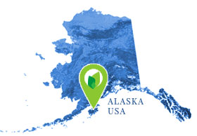
The coastal areas of Afognak Island are home to 200-year old forests, river otters, beavers, martens and ermines. Offshore in the coastal waters, sea lions and harbor seals swim in sight of humpback whales. This pristine environment also has an increasingly important environmental value: the old-growth trees sequester millions of tonnes of carbon dioxide. This creates a new resource opportunity for the forest and habitat based on their environmental benefits.
Afognak Island has retained large tracts of undisturbed native trees (180-250 years old) along with regenerated growth of trees over the past 30 years. Afognak is also home to Alaska’s largest herd of elk. The Afognak Forest Carbon Project represents over a decade’s worth of dedicated efforts by dozens of individuals, in partnership with the Rocky Mountain Elk Foundation and the American Land Conservancy, to conserve a truly unique ecosystem in perpetuity. In 2008, this pioneering effort affected a shift from timber production management to conservation management across the five parcels that constitute the Afognak Project. The Afognak forest carbon project represents the first project of its kind in the state of Alaska.
Kodiak bears and Native peoples co-existed for centuries on the island before the towering Sitka spruce trees first took hold some 800 years ago. The first European laid eyes on Afognak Island in 1741 and Russian fur trappers soon followed. Beginning in the 19th century, Americans were increasingly concerned with the destruction of wildlife and saw value in conservation. Yosemite, Yellowstone and Afognak Island were seen as irreplaceable wilderness worth preserving. Thanks to President Theodore Roosevelt, in 1907, Afognak Island was offically designated as a National Forest. Protecting Native Species Afognak is home to many species endemic to Alaska: Roosevelt Elk, Pacific Salmon, Steelhead, Rainbow Trout, Arctic Char, Dolly Varden, Kodiak Brown Bear, Bald Eagle, Marbled Murrelet, River Otter, Tundra Vole, Sitka-black Tailed Deer, Mountain Goat and Snowshoe Hare. The preservation of natural forest habitat is important for the continued survival of these species. .
Environmental co-benefits include the prevention of land disruption and the greenhouse gas emissions from timber logging. The project restores and protects habitat for native plant, mammal, bird and fish species.
La Perseverancia Landfill is an excellent example of how a landfill gas (LFG) collection and destruction system can have multiple uses. The project destroys methane (biogas), a potent greenhouse gas, in a controlled and measured manner. The project also provides renewable electricity, and opportunities for community education.
La Perseverancia landfill, located in Cuautla, Morelos collects waste from 13 municipalities in the state of Morelos. Cuautla is about 75 km South of Mexico City, south of El Tepozteco National Park. The development of this project is an example of a carefully negotiated effective public/private partnership between the municipality of Cuautla and Operadora de Ferrocarril y Manejo de Rellenos SA de CV. This biogas to energy plant provides environmental, social and economic benefits. It is a winner of the Guangzhou International Award for Urban Innovation.
The management of municipal waste is a challenge. Many of us don’t know, or want to think about the end of life of our trash. La Perseverancia is a leader in sustainable development for waste management.
Five cells within the landfill are fitted with vertical and horizontal extraction wells. The project has a blower that provides flow of the biogas into the destruction devices. Data from flow meters are automatically recorded every 15 minutes. This monitoring is continuous throughout the reporting period.
A “knock out pot” is used to capture condensate in the biogas, enabling better engine operation. Electricity is produced from a biogas fueled 4-stroke engine, which is connected to a generator. The engine, fueled by the collected biogas is capable of running on such a rich burning fuel. The facility also has a backup flare that can only be used when the engine/generator isn’t running. All methane collected by the system is destroyed in one of these two devices.
The project has provided new employment opportunities, creating jobs at all levels of education and skills. Through collaboration agreements with local universities, students are able to intern, learning about sustainable waste management at this innovative project. Students get professional experience in waste to energy development.
The project also cooperates with international partners.
“The innovative part of this project has caught the attention of the region of Tolima in Colombia and a South-South cooperation project has taken place with the support of both Cooperation Agencies of Mexico and Colombia supporting the exchange happening between the two local governments in the field of solid waste management and the best practices.”
The Project reduced emissions into the atmosphere by 12,501 metric tons CO2-e for the reporting period 15 June 2016 through 14 June 2017. The project’s crediting period will continue through 2024. This project meets all the requirements of Climate Action Reserve’s Mexico Landfill Project Protocol, Version 1.1
The Kulera Landscape project provides 5-km buffer areas around three important nature reserves in the African nation of Malawi: Nyika National Park, Vwaza Wildlife Reserve, and the Nkhotakota Wildlife Reserve, including a total project area of 217,270 hectares. These buffer zones protect forests and biodiversity, provide for improved regional governance, and facilitate sustainable forestry and agriculture in the project region. The project’s carbon credits are developed from the careful accounting and independent third-party verification of the carbon sequestered through growing trees in the project zone.
Encroachment and deforestation of the protected areas (typically for the procurement of wood and other resources) is now significantly mitigated by enhanced enforcement. This is done hand-in-hand with addressing the environmental, social and economic needs of local communities (such as the indigienous Chewa people) to provide alternative and sustainable livelihoods.
The Kulera project formally includes the Malawi Department of Natural Parks and Wildlife and the communities as project proponents. The project provides for the formation of Community Associations with democratically elected representatives from villages around the protected areas. Through this governance, the communities are empowered to actively engage with its lawful and contractual obligations. The communities are active participants in implementing sustainable agriculture and forestry, distribution and use of efficient cookstoves, and enforcement against poaching. Community members have also received training on conservation agriculture, natural resource management, tree regeneration, establishment of tree nurseries, and tree planting. The project provides training in business skills and marketing for entrepreneurs. Alternative energy and fuel-efficiency solutions are also being introduced into the region.
Malawi is a sub-tropical land-locked country of high mountains and deep lakes in southeast Africa. One-fifth of it is covered by Lake Malawi, which fills the trough of the Great African Rift Valley that traverses the country from north to south. East and west of the lake, the land forms high plateaus that reach as high as 2,600 meters in the Nyika uplands, and 3,048 meters at Mount Mulanje.
Malawi ranks among the world’s least developed countries. About 80% of the population lives in rural areas, with agriculture accounting for a third of the country’s GDP and 80% of the country’s exports. With almost 20 million people, slowing, but still rapid population growth continues to put pressure on Malawi’s land, water, and forest resources. Reduced plot sizes and increasing vulnerability to climate change threatens the sustainability of Malawi’s agriculturally based economy and will worsen food shortages.
Malawi’s highland forests, rivers, and Lake Malawi provide important habitat for many diverse species of flora and fauna. The country is home to elephants, baboons, black rhinos, buffalos, waterbucks, bushbucks, crocodiles, hippos, Livingstone’s eland, Lichtenstein’s hartebeest, sable antelope, nyala, Burchell’s zebra, impala, warthog, and more.
The Kulera Landscape project is registered with the Verra Verified Carbon Standard (VCS) and Climate, Community, and Biodiversity Standard (CCB). In addition, as a REDD+ verified project (REDD+ stands for Reduce Emissions from Deforestation and Forest Degradation), it meets high standards established by the REDD+ international framework for forest management programs and associated co-benefits such as environmental conservation and restoration, economic stimulus, training, and entrepreneurship opportunities.